Entropia Museum is a community-driven archive preserving the history of Entropia Universe. If you would like to help support the hosting and development of the archive, you can contribute below.
This archive presents historical maps from across Entropia Universe, showing how locations have appeared at different points in time. Each map reflects the exact state of the world when the image was captured.
Two different time references are used on this page:
Year — when the screenshot was taken
Version Update (VU) — when the location or system was first introduced
These will often differ. A map captured in a later year may still belong to a location
originally released in an earlier Version Update.
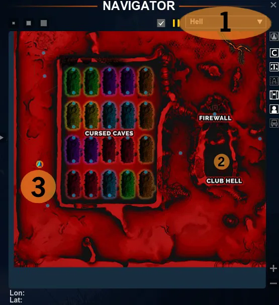
The map features a predominantly red terrain with a grid layout of Cursed Caves. Notable locations include Club Hell and a Firewall, both labeled clearly. Additional markings indicate coordinates at the bottom left.
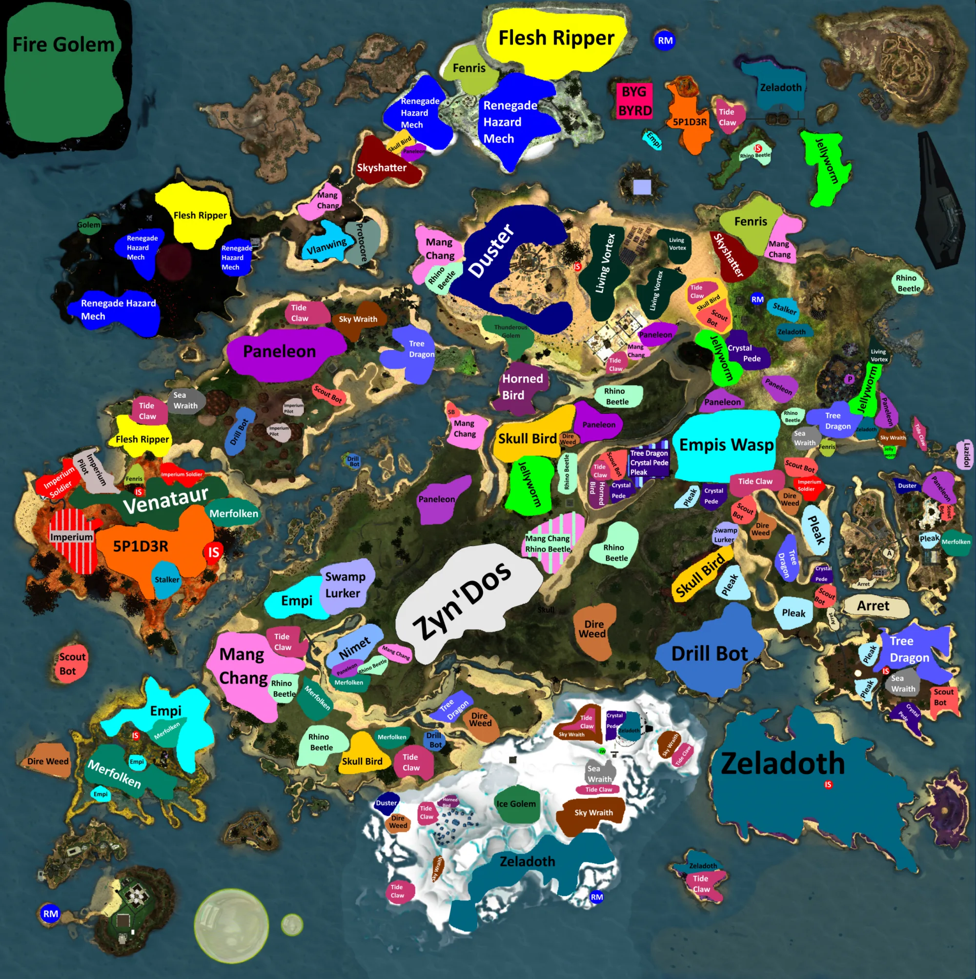
The map features a variety of colored regions representing different creatures and locations. Notable areas include 'Venataur,' 'Zyn'Dos,' and 'Zeladoth,' with paths and borders delineating each section. Numerous labels identify specific creatures and entities throughout the landscape.
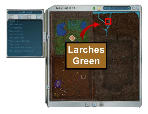
The map features a segmented layout with distinct regions, including a highlighted area labeled 'Larches Green.' Various terrains are visible, with patches of green and blue indicating water bodies. Pathways and structural markings are present, enhancing navigation through the landscape.
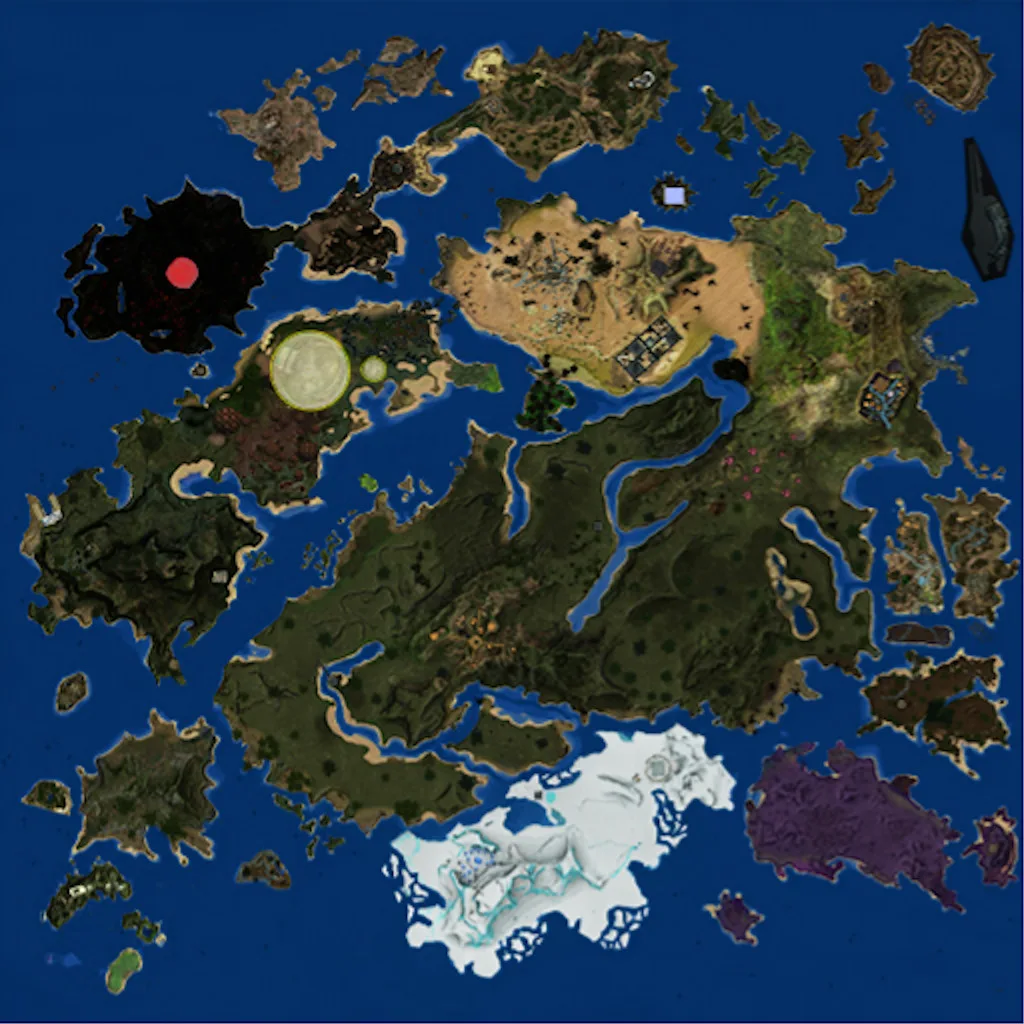
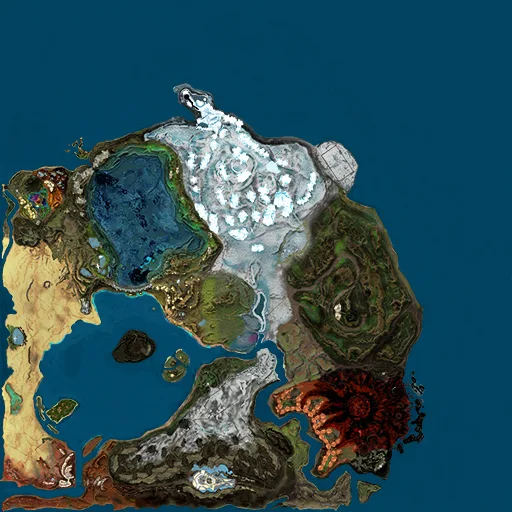
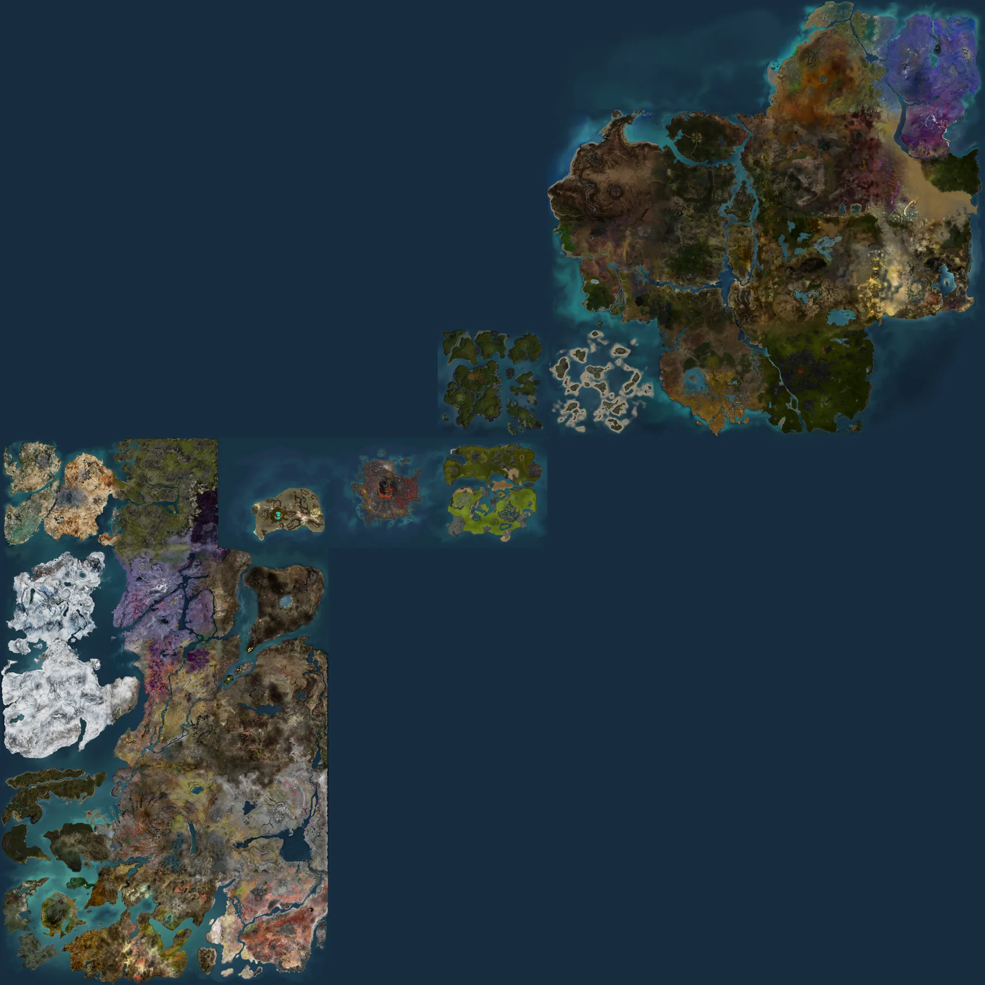
The map features a variety of landmasses with distinct shapes and colors, including green, brown, and icy white regions. Visible paths and waterways connect different areas, while circular and irregular markings suggest points of interest. The background is predominantly blue, representing water bodies surrounding the land.
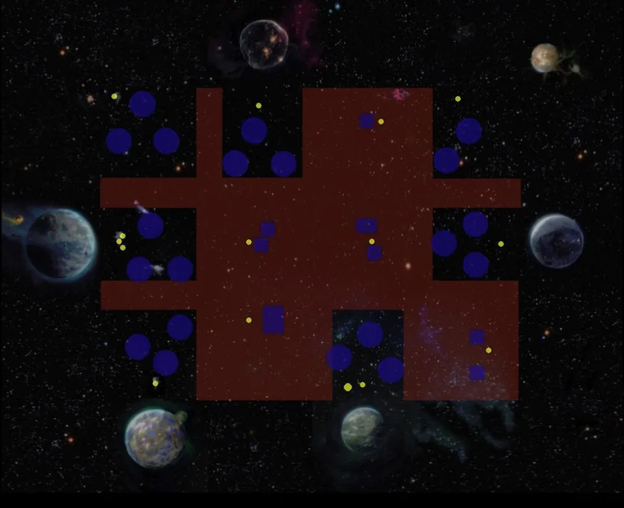
The map features a central red landmass with various circular and square markers in blue and yellow. Paths extend from the central area, connecting to clusters of blue circles scattered around the perimeter. No specific labels or text are visible on the map.
The map features a variety of landmasses with distinct shapes and colors, including rocky, green, and sandy regions. Waterways are visible, creating divisions between different terrains. Some areas are marked with lighter colors, possibly indicating elevation changes or specific land types.
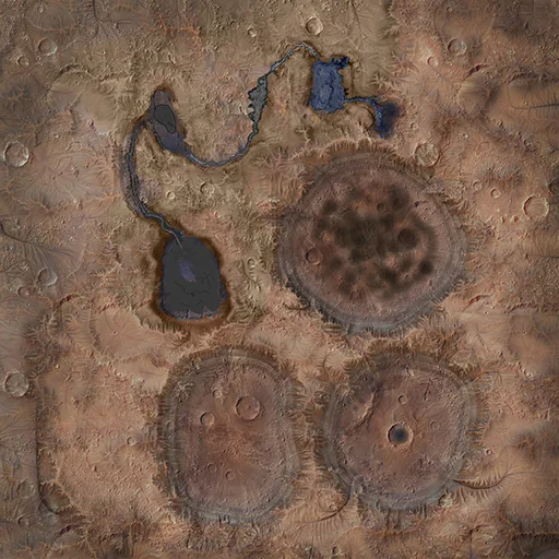
The map features a textured terrain with varying shades of brown and blue, indicating land and water. Three prominent circular structures are visible, along with a winding waterway leading to a larger body of water. No specific labels or markings are present.
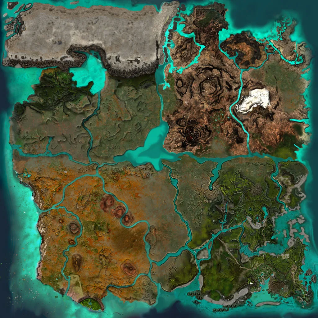
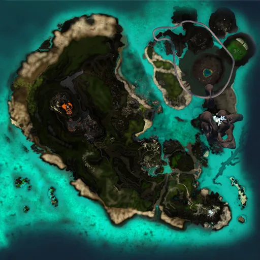
The map features a large, irregularly shaped landmass surrounded by turquoise waters. Various regions display distinct terrain colors, with dark green areas indicating dense vegetation and lighter sections suggesting sandy or rocky landscapes. Paths and structural markings are visible, along with circular formations and labels that denote specific locations.
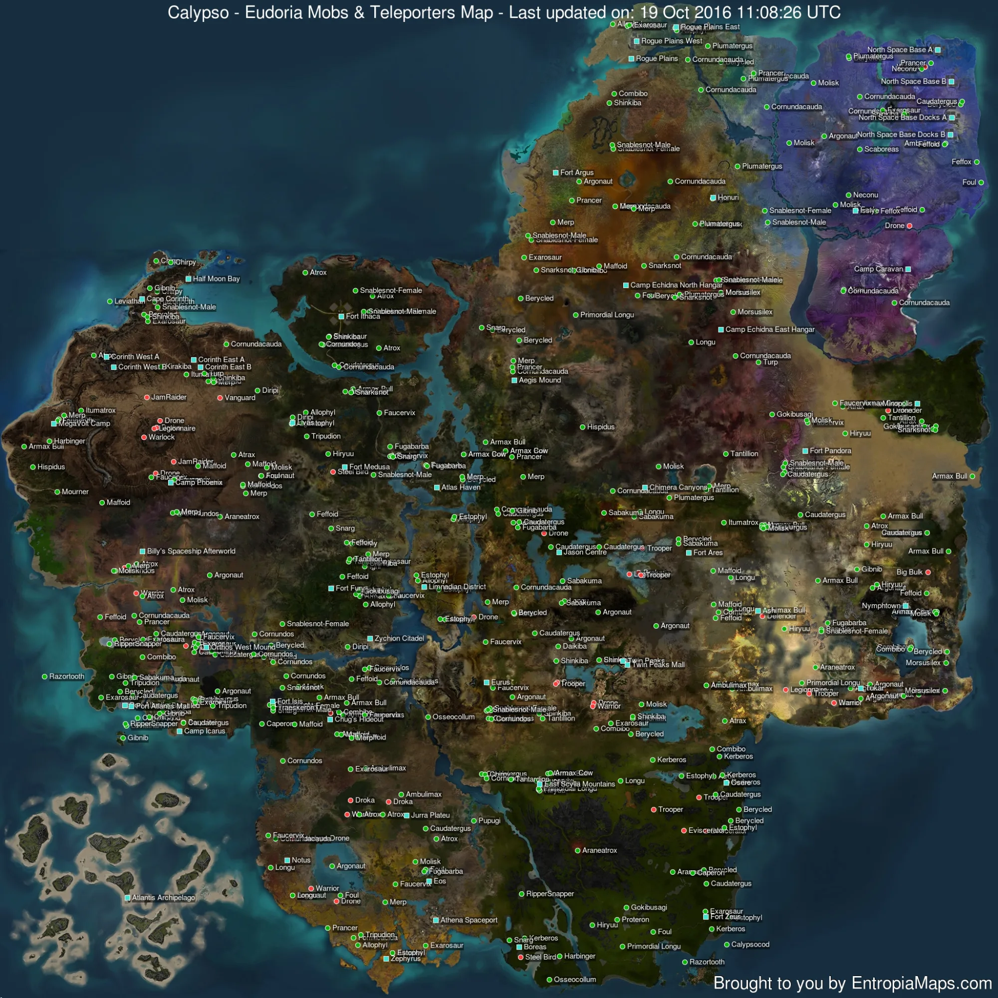
The map features a diverse landscape with various terrain colors indicating different regions. Numerous labeled locations are scattered throughout, including teleporters and mob spawn points. Paths and borders are marked, providing a structured layout for navigation.
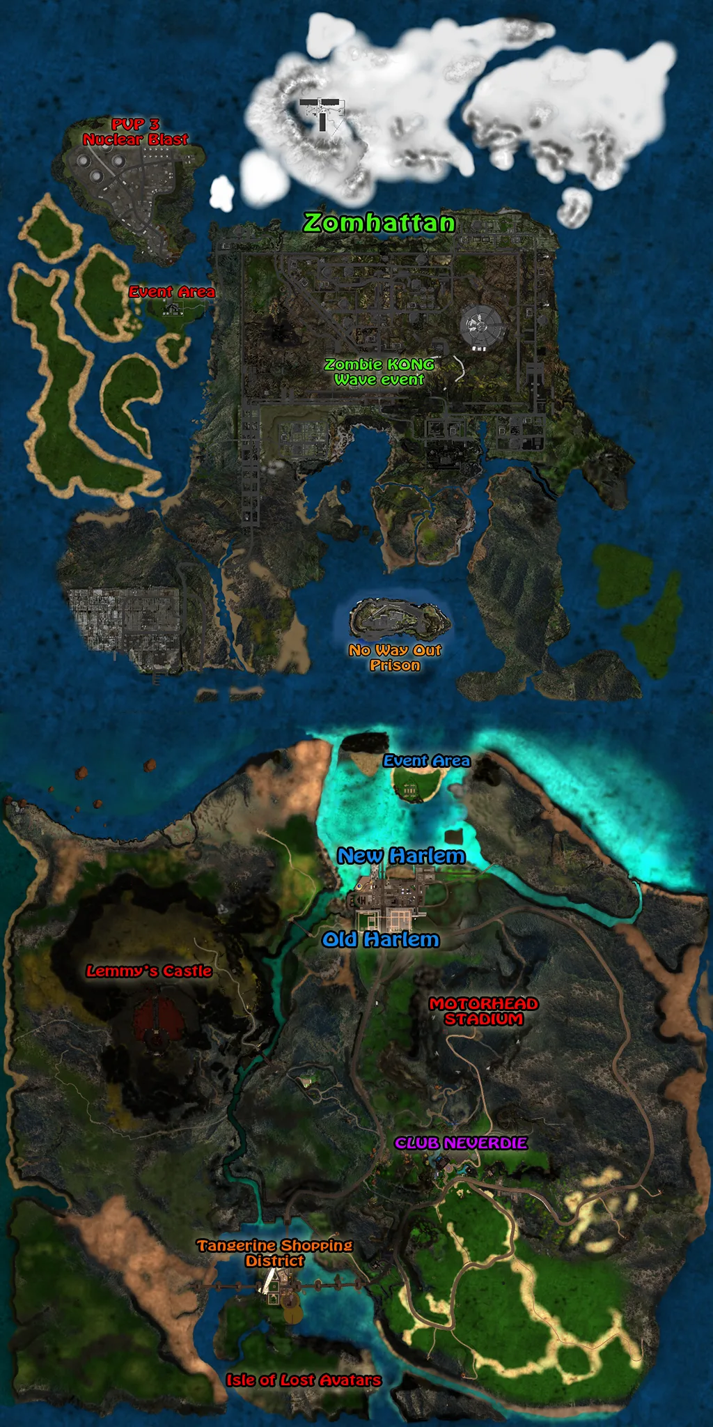
The map features a diverse layout with landmasses and water bodies. Key regions include Zombattan, New Harlem, and Old Harlem, with various marked locations such as Lemmy's Castle and Club Neverdie. Several paths and event areas are indicated, along with notable landmarks like Motorhead Stadium and No Way Out Prison.
The map features a variety of landmasses with distinct shapes and textures, including large bodies of water and mountainous regions. Visible paths and divisions suggest connectivity between different areas. Various labels and markings are present, indicating specific locations or features.
The map features a diverse layout of landmasses and islands, with distinct regions of varying terrain coloration. Prominent areas include icy regions, lush greens, and rocky landscapes, separated by water bodies. Some labels and markings are visible, indicating specific locations and paths.
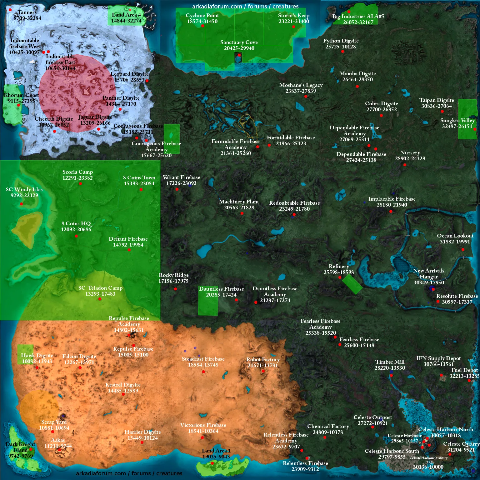
The map features a variety of landmasses and regions, each with distinct colorations indicating different terrains. Numerous labels mark specific locations, including camps, academies, and factories, along with coordinate references. Pathways and structural markings are visible, suggesting routes between these points.
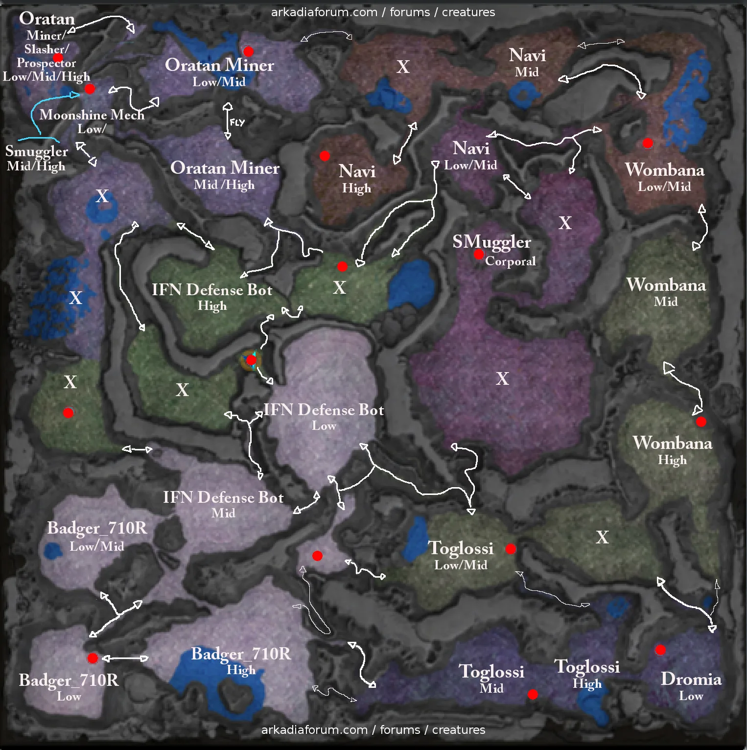
The map features a complex layout with distinct colored regions representing various terrains. Visible paths connect different areas, with numerous labeled entities such as 'Oratan Miner' and 'IFN Defense Bot' indicating their respective levels. Red dots mark specific locations, while white arrows suggest movement directions.
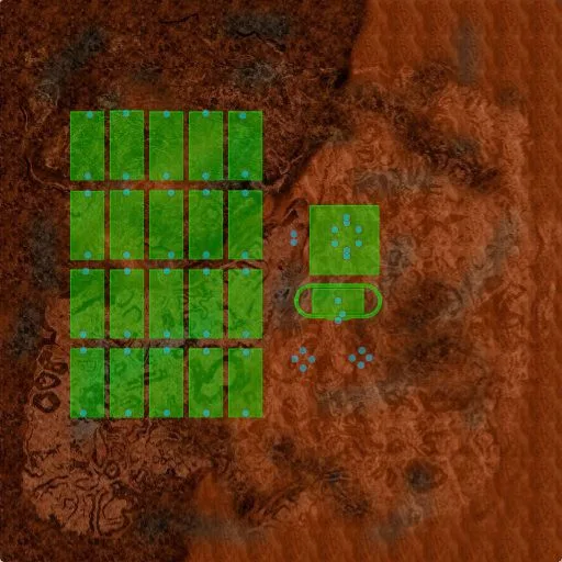
The map features a grid layout of green zones arranged in rectangular shapes, with several structures and markings. Notable elements include circular and rectangular formations, along with blue dots that may represent points of interest. The surrounding terrain is a reddish-brown color, indicating a distinct separation from the green areas.
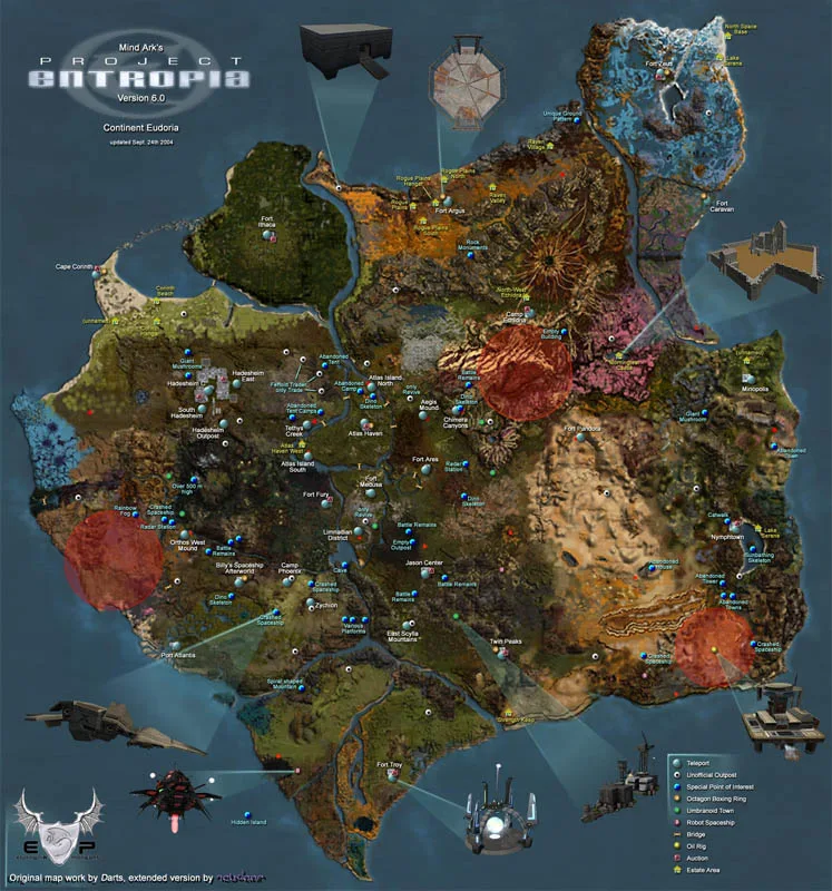
The map features a diverse layout of landmasses with varying terrain colors, including green, brown, and red zones. Numerous labeled locations, such as forts and outposts, are scattered throughout, connected by visible paths. Additional markings indicate teleport points and areas of interest.
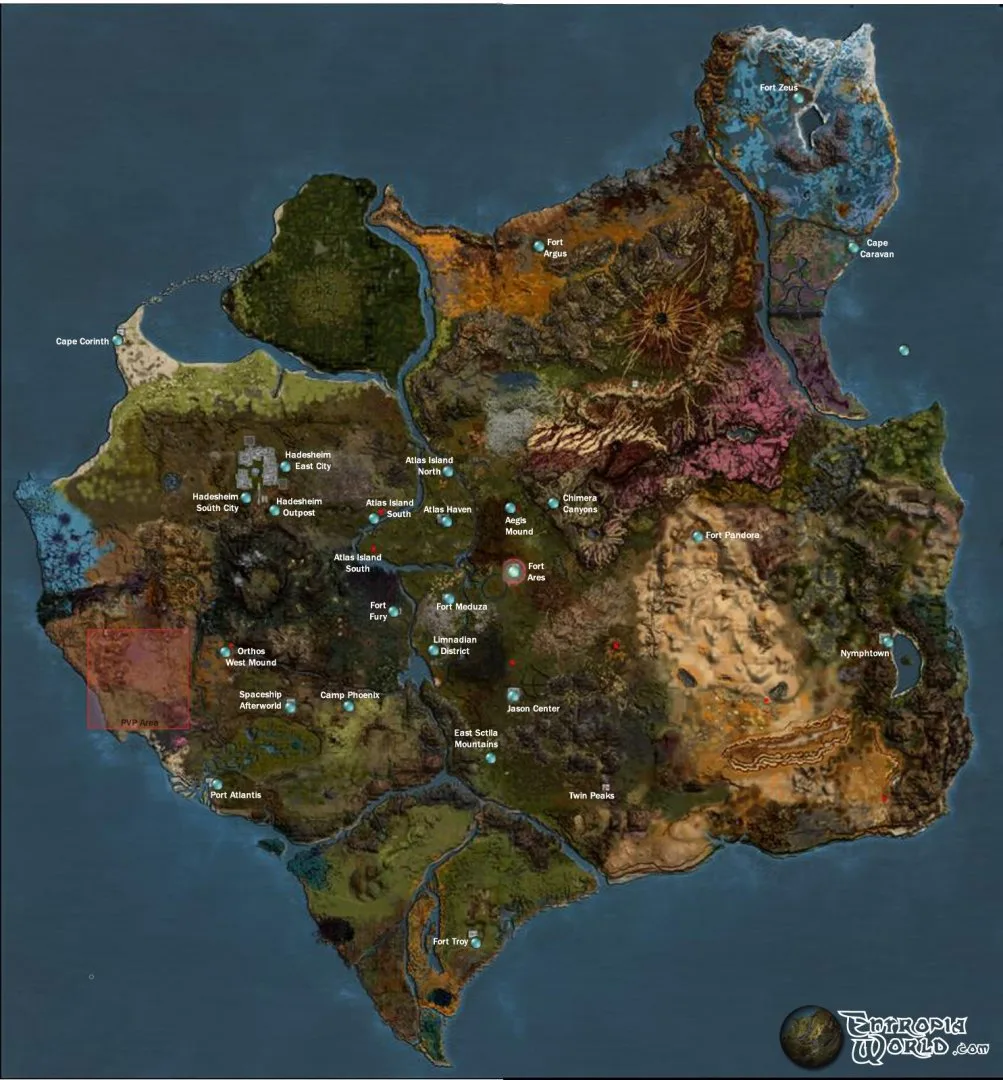
The map features a variety of landmasses with distinct shapes and colors, indicating different terrains. Visible regions include cities, forts, and mounds, interconnected by paths and roads. Labels mark specific locations, providing a clear layout of the area.
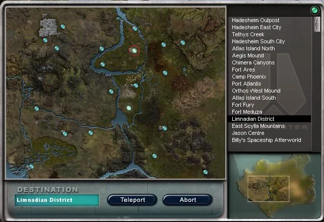
The map features a detailed layout of the Limnadian District and nearby regions. Visible paths and locations include Hadesheim Outpost, Fort Ares, and various other points of interest marked by blue dots. Labels clearly indicate these locations along with a navigation interface at the bottom.